Weather Alert in Alaska
Winter Storm Watch issued August 26 at 10:01PM AKDT until August 28 at 10:00PM AKDT by NWS Fairbanks AK
AREAS AFFECTED: Western Arctic Plains; Howard Pass and the Delong Mountains
DESCRIPTION: * WHAT...Ice accumulations of 0.1" to 0.25" are possible. * WHERE...Howard Pass and the Delong Mountains and Western Arctic Plains. * WHEN...From late Wednesday night through Thursday evening. * IMPACTS...Ice accumulations will lead to hazardous travel conditions and very slick surfaces. Significant ice accumulation on power lines may cause power outages. * ADDITIONAL DETAILS...The greatest ice accumulations are expected along the northern slopes of the Northwestern Brooks Range and Western Arctic Coastal Plains. There is high uncertainty in potential ice amounts extending northeast of this location, though ice accumulations Thursday into Thursday night appear increasingly possible as far northeast as Nuiqsut, Prudhoe Bay, and the northern extent of the Dalton Highway.
INSTRUCTION: Persons should consider delaying all travel. Motorists should use extreme caution if travel is absolutely necessary.
Want more detail? Get the Complete 7 Day and Night Detailed Forecast!
Current U.S. National Radar--Current
The Current National Weather Radar is shown below with a UTC Time (subtract 5 hours from UTC to get Eastern Time).

National Weather Forecast--Current
The Current National Weather Forecast and National Weather Map are shown below.

National Weather Forecast for Tomorrow
Tomorrow National Weather Forecast and Tomorrow National Weather Map are show below.

North America Water Vapor (Moisture)
This map shows recent moisture content over North America. Bright and colored areas show high moisture (ie, clouds); brown indicates very little moisture present; black indicates no moisture.

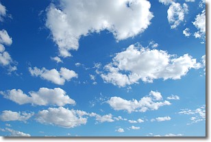
Weather Topic: What are Cumulonimbus Clouds?
Home - Education - Cloud Types - Cumulonimbus Clouds
 Next Topic: Cumulus Clouds
The final form taken by a growing cumulus cloud is the
cumulonimbus cloud, which is very tall and dense.
The tower of a cumulonimbus cloud can soar 23 km into the atmosphere, although
most commonly they stop growing at an altitude of 6 km.
Even small cumulonimbus clouds appear very large in comparison to other cloud types.
They can signal the approach of stormy weather, such as thunderstorms or blizzards.
Next Topic: Cumulus Clouds
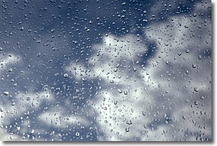
Weather Topic: What is Drizzle?
Home - Education - Precipitation - Drizzle
 Next Topic: Evaporation
Drizzle is precipitation in the form of water droplets which are
smaller than raindrops.
Drizzle is characterized by fine, gently falling droplets and typically does not
impact human habitation in a negative way. The exception to this is freezing drizzle,
a condition where drizzle freezes immediately upon reaching earth's surface.
Freezing drizzle is still less dangerous than freezing rain, but can
potentially result in hazardous road conditions.
Next Topic: Evaporation
Current conditions powered by WeatherAPI.com


