Weather Alert in South Carolina
Flash Flood Warning issued August 22 at 1:09PM EDT until August 22 at 2:30PM EDT by NWS Charleston SC
AREAS AFFECTED: Charleston, SC
DESCRIPTION: At 109 PM EDT, emergency management officials reported a number of flooded and closed roads in the Mount Pleasant area. Radar shows thunderstorms with torrential rainfall continuing to impact Mount Pleasant, Isle of Palms and Sullivans Island. An additional 1 to 2 inches could fall through 230 PM. The risk for additional flash flooding continues. HAZARD...Flash flooding caused by thunderstorms. SOURCE...Emergency management reported. IMPACT...Flash flooding of small creeks and streams, urban areas, highways, streets and underpasses as well as other poor drainage and low-lying areas. Some locations that will experience flash flooding include... Mount Pleasant, Isle Of Palms, Sullivan's Island, Mount Pleasant Towne Centre, Boone Hall Plantation, Sullivans Island, Seaside Farms, East Cooper Regional Medical Center, Hamlin Plantation and Snowden. This includes I-526 between mile markers 29 and 31.
INSTRUCTION: Turn around, don't drown when encountering flooded roads. Most flood deaths occur in vehicles.
Want more detail? Get the Complete 7 Day and Night Detailed Forecast!
Current U.S. National Radar--Current
The Current National Weather Radar is shown below with a UTC Time (subtract 5 hours from UTC to get Eastern Time).

National Weather Forecast--Current
The Current National Weather Forecast and National Weather Map are shown below.

National Weather Forecast for Tomorrow
Tomorrow National Weather Forecast and Tomorrow National Weather Map are show below.

North America Water Vapor (Moisture)
This map shows recent moisture content over North America. Bright and colored areas show high moisture (ie, clouds); brown indicates very little moisture present; black indicates no moisture.

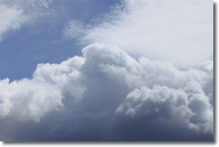
Weather Topic: What are Nimbostratus Clouds?
Home - Education - Cloud Types - Nimbostratus Clouds
 Next Topic: Precipitation
A nimbostratus cloud is similar to a stratus cloud in its formless,
smooth appearance. However, a nimbostratus cloud is darker than a stratus cloud,
because it is thicker.
Unlike a stratus cloud, a nimbostratus cloud typically brings with it the threat
of moderate to heavy precipitation. In some cases, the precipitation may evaporate
before reaching the ground, a phenomenon known as virga.
Next Topic: Precipitation
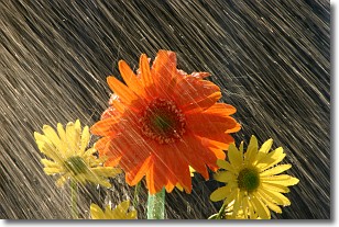
Weather Topic: What is Rain?
Home - Education - Precipitation - Rain
 Next Topic: Shelf Clouds
Precipitation in the form of water droplets is called rain.
Rain generally has a tendency to fall with less intensity over a greater period
of time, and when rainfall is more severe it is usually less sustained.
Rain is the most common form of precipitation and happens with greater frequency
depending on the season and regional influences. Cities have been shown to have
an observable effect on rainfall, due to an effect called the urban heat island.
Compared to upwind, monthly rainfall between twenty and forty miles downwind of
cities is 30% greater.
Next Topic: Shelf Clouds
Current conditions powered by WeatherAPI.com


