Weather Alert in Kansas
Hydrologic Outlook issued August 27 at 1:45PM CDT by NWS Topeka KS
AREAS AFFECTED: Lyon, KS
DESCRIPTION: ESFTOP Cottonwood River near Emporia This hydrologic outlook is based on the forecast rainfall for the next 24 hours and estimated runoff from earlier rainfall. Crests may vary if actual rainfall or runoff is greater or less than anticipated. Location: Cottonwood River near Emporia Flood stage: 20.0 feet Latest stage: 2.6 feet at 7 AM Wednesday Maximum Forecast Stage: 22.7 feet at 7 PM Friday Aug 29 Fld Obs Forecasts Location Stg Stg Day/Time Wed Thu Fri 1pm 1pm 1pm Cottonwood River Emporia 20.0 2.6 Wed 7am 2.6 13.5 22.5 Later statements, possibly warnings, may be issued as additional information becomes available.
INSTRUCTION: N/A
Want more detail? Get the Complete 7 Day and Night Detailed Forecast!
Current U.S. National Radar--Current
The Current National Weather Radar is shown below with a UTC Time (subtract 5 hours from UTC to get Eastern Time).

National Weather Forecast--Current
The Current National Weather Forecast and National Weather Map are shown below.

National Weather Forecast for Tomorrow
Tomorrow National Weather Forecast and Tomorrow National Weather Map are show below.

North America Water Vapor (Moisture)
This map shows recent moisture content over North America. Bright and colored areas show high moisture (ie, clouds); brown indicates very little moisture present; black indicates no moisture.

Weather Topic: What is Condensation?
Home - Education - Precipitation - Condensation
 Next Topic: Contrails
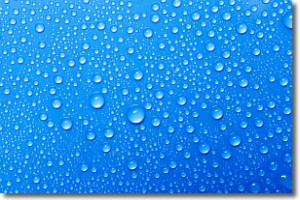
Condensation is the process which creates clouds, and therefore
it is a crucial process in the water cycle.
Condensation is the change of matter from a state of gas into a state of liquid,
and it happens because water molecules release heat into the atmosphere and
become organized into a more closely packed structure, what we might see as
water droplets.
Water is always present in the air around us as a vapor, but it's too small for
us to see. When water undergoes the process of condensation it becomes organized
into visible water droplets. You've probably seen condensation happen before on the
surface of a cold drink!
Next Topic: Contrails
Weather Topic: What are Cumulonimbus Clouds?
Home - Education - Cloud Types - Cumulonimbus Clouds
 Next Topic: Cumulus Clouds
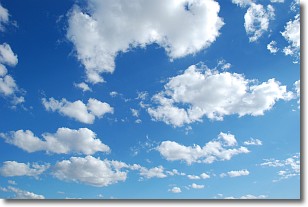
The final form taken by a growing cumulus cloud is the
cumulonimbus cloud, which is very tall and dense.
The tower of a cumulonimbus cloud can soar 23 km into the atmosphere, although
most commonly they stop growing at an altitude of 6 km.
Even small cumulonimbus clouds appear very large in comparison to other cloud types.
They can signal the approach of stormy weather, such as thunderstorms or blizzards.
Next Topic: Cumulus Clouds
Current conditions powered by WeatherAPI.com


