Weather Alert in Alaska
Hydrologic Outlook issued August 26 at 1:47PM AKDT by NWS Anchorage AK
AREAS AFFECTED: Anchorage; Anchorage Hillside / Eagle River; East Turnagain Arm; Portage; Lower Matanuska Valley; Hatcher Pass; Sutton / Upper Matanuska Valley; Eureka / Tahneta Pass; Southern Kachemak Bay; SW Kenai Peninsula; NW Kenai Peninsula; Skilak Lake; Southern Kenai Mtns; Interior Kenai Peninsula; Turnagain Pass; West Prince William Sound & Whittier; Tyonek; Valdez; Thompson Pass; Cordova; Western Susitna Valley; Southern Susitna Valley; Central Susitna Valley; Northern Susitna Valley
DESCRIPTION: ESFAFC Rainfall: * Eastern Kenai Peninsula and Prince William Sound: 2 to 4 inches with locally higher amounts in higher terrain. * Mat-Su Valley: 1 to 3 inches with locally higher amounts. The highest rainfall totals are likely to be across the northern Susitna Valley. * Western Kenai Peninsula and Anchorage: 1 to 2 inches of rainfall with the heaviest rainfall occuring adjacent to Cook Inlet. Downsloping at times may result in localized lower amounts immediately west of the mountains. Hydrologic Concerns * Expect sharp rises on many small streams and rivers. Many smaller streams will crest Thursday night into Friday while larger rivers or downstream points may crest Friday and Saturday. Higher than normal water levels may continue through Labor Day Weekend into next week. * Many lower locations along rivers such as gravel bars and other spots popular for camping and recreating are likely to become inundated with water. * Heavy rain may result in localized ponding in low-lying areas and locations with poor drainage. Confidence and Next Steps * Confidence is high that a multi-day heavy rainfall event will occur across Southcentral Alaska, with the northern Susitna Valley and Prince William Sound receiving the heaviest rainfall. Confidence is medium regarding rainfall totals and placement of heaviest rainfall. If forecast rainfall totals hold or increase, flood watches may be needed for portions of the Kenai Peninsula, Mat-Su Valley, or elsewhere. * Residents along area streams as well as river users and recreationists should anticipate higher than normal water levels and are advised to monitor weather and river forecasts. * Reports on river conditions may be sent to the river forecast center by calling 1-800-847-1739.
INSTRUCTION: N/A
Want more detail? Get the Complete 7 Day and Night Detailed Forecast!
Current U.S. National Radar--Current
The Current National Weather Radar is shown below with a UTC Time (subtract 5 hours from UTC to get Eastern Time).

National Weather Forecast--Current
The Current National Weather Forecast and National Weather Map are shown below.

National Weather Forecast for Tomorrow
Tomorrow National Weather Forecast and Tomorrow National Weather Map are show below.

North America Water Vapor (Moisture)
This map shows recent moisture content over North America. Bright and colored areas show high moisture (ie, clouds); brown indicates very little moisture present; black indicates no moisture.

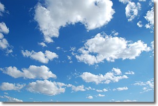
Weather Topic: What are Cumulonimbus Clouds?
Home - Education - Cloud Types - Cumulonimbus Clouds
 Next Topic: Cumulus Clouds
The final form taken by a growing cumulus cloud is the
cumulonimbus cloud, which is very tall and dense.
The tower of a cumulonimbus cloud can soar 23 km into the atmosphere, although
most commonly they stop growing at an altitude of 6 km.
Even small cumulonimbus clouds appear very large in comparison to other cloud types.
They can signal the approach of stormy weather, such as thunderstorms or blizzards.
Next Topic: Cumulus Clouds
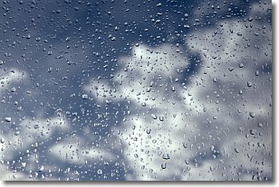
Weather Topic: What is Drizzle?
Home - Education - Precipitation - Drizzle
 Next Topic: Evaporation
Drizzle is precipitation in the form of water droplets which are
smaller than raindrops.
Drizzle is characterized by fine, gently falling droplets and typically does not
impact human habitation in a negative way. The exception to this is freezing drizzle,
a condition where drizzle freezes immediately upon reaching earth's surface.
Freezing drizzle is still less dangerous than freezing rain, but can
potentially result in hazardous road conditions.
Next Topic: Evaporation
Current conditions powered by WeatherAPI.com


