Weather Alert in Iowa
Tornado Watch issued April 2 at 1:45PM CDT until April 2 at 8:00PM CDT by NWS Des Moines IA
AREAS AFFECTED: Appanoose, IA; Clarke, IA; Davis, IA; Decatur, IA; Jasper, IA; Lucas, IA; Mahaska, IA; Marion, IA; Marshall, IA; Monroe, IA; Polk, IA; Poweshiek, IA; Tama, IA; Wapello, IA; Warren, IA; Wayne, IA
DESCRIPTION: THE NATIONAL WEATHER SERVICE HAS ISSUED TORNADO WATCH 89 IN EFFECT UNTIL 8 PM CDT THIS EVENING FOR THE FOLLOWING AREAS IN IOWA THIS WATCH INCLUDES 16 COUNTIES IN CENTRAL IOWA JASPER MARSHALL POLK POWESHIEK TAMA IN SOUTH CENTRAL IOWA APPANOOSE CLARKE DECATUR LUCAS MAHASKA MARION MONROE WARREN WAYNE IN SOUTHEAST IOWA DAVIS WAPELLO THIS INCLUDES THE CITIES OF ALBIA, ALLERTON, BLOOMFIELD, CARLISLE, CENTERVILLE, CHARITON, CORYDON, DES MOINES, DYSART, GLADBROOK, GRINNELL, HUMESTON, INDIANOLA, KNOXVILLE, LAMONI, LEON, MARSHALLTOWN, NEWTON, NORWALK, OSCEOLA, OSKALOOSA, OTTUMWA, PELLA, SEYMOUR, TAMA, TOLEDO, AND TRAER. * PRIMARY THREATS INCLUDE... A FEW TORNADOES LIKELY WITH A COUPLE INTENSE TORNADOES POSSIBLE. SCATTERED DAMAGING WINDS AND ISOLATED SIGNIFICANT GUSTS TO 75 MPH LIKELY. SCATTERED LARGE HAIL AND ISOLATED VERY LARGE HAIL EVENTS TO 2 INCHES IN DIAMETER POSSIBLE. PROBABILITY TABLE: PROB OF 2 OR MORE TORNADOES : 70% PROB OF 1 OR MORE STRONG /EF2-EF5/ TORNADOES : 40% PROB OF 10 OR MORE SEVERE WIND EVENTS : 70% PROB OF 1 OR MORE WIND EVENTS >= 75 MPH : 60% PROB OF 10 OR MORE SEVERE HAIL EVENTS : 40% PROB OF 1 OR MORE HAIL EVENTS >= 2 INCHES : 30% PROB OF 6 OR MORE COMBINED SEVERE HAIL/WIND EVENTS : 90% MEAN STORM MOTION /MPH/ : E 40
INSTRUCTION: N/A
Want more detail? Get the Complete 7 Day and Night Detailed Forecast!
Current U.S. National Radar--Current
The Current National Weather Radar is shown below with a UTC Time (subtract 5 hours from UTC to get Eastern Time).

National Weather Forecast--Current
The Current National Weather Forecast and National Weather Map are shown below.

National Weather Forecast for Tomorrow
Tomorrow National Weather Forecast and Tomorrow National Weather Map are show below.

North America Water Vapor (Moisture)
This map shows recent moisture content over North America. Bright and colored areas show high moisture (ie, clouds); brown indicates very little moisture present; black indicates no moisture.

Weather Topic: What is Sleet?
Home - Education - Precipitation - Sleet
 Next Topic: Snow
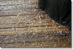
Sleet is a form of precipitation in which small ice pellets are the primary
components. These ice pellets are smaller and more translucent than hailstones,
and harder than graupel. Sleet is caused by specific atmospheric conditions and
therefore typically doesn't last for extended periods of time.
The condition which leads to sleet formation requires a warmer body of air to be
wedged in between two sub-freezing bodies of air. When snow falls through a warmer
layer of air it melts, and as it falls through the next sub-freezing body of air
it freezes again, forming ice pellets known as sleet. In some cases, water
droplets don't have time to freeze before reaching the surface and the result is
freezing rain.
Next Topic: Snow
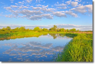
Weather Topic: What are Stratocumulus Clouds?
Home - Education - Cloud Types - Stratocumulus Clouds
 Next Topic: Stratus Clouds
Stratocumulus clouds are similar to altocumulus clouds in their
fluffy appearance, but have a slightly darker shade due to their additional mass.
A good way to distinguish the two cloud types is to hold your hand out and measure
the size of an individual cloud; if it is the size of your thumb it is generally
an altocumulus cloud, if it is the size of your hand it is generally a
stratocumulus cloud.
It is uncommon for stratocumulus clouds to produce precipitation, but if they do
it is usually a light rain or snow.
Next Topic: Stratus Clouds
Current conditions powered by WeatherAPI.com


