Weather Alert in Minnesota
Flood Warning issued August 23 at 9:13PM CDT by NWS Twin Cities/Chanhassen MN
AREAS AFFECTED: Chippewa, MN; Lac qui Parle, MN; Yellow Medicine, MN
DESCRIPTION: ...The Flood Warning continues for the following rivers in Minnesota... Minnesota River at New Ulm affecting Nicollet, Brown and Blue Earth Counties. Minnesota River at Henderson MN19 affecting Scott, Sibley and Le Sueur Counties. Minnesota River near Jordan affecting Sibley, Carver and Scott Counties. Minnesota River at Granite Falls HWY 212 affecting Yellow Medicine, Renville and Chippewa Counties. Minnesota River at Morton affecting Redwood and Renville Counties. Minnesota River at Montevideo affecting Yellow Medicine, Lac qui Parle and Chippewa Counties. ...The Flood Warning is extended for the following rivers in Minnesota... Redwood River near Redwood Falls affecting Redwood County. ...The Flood Warning is cancelled for the following rivers in Minnesota... Cottonwood River Above Springfield affecting Brown County. * WHAT...Minor flooding is occurring and moderate flooding is forecast. * WHERE...Minnesota River at Montevideo. * WHEN...Until further notice. * IMPACTS...At 17.0 feet, Storm sewers may need to be plugged to prevent water from backing up into streets. * ADDITIONAL DETAILS... - At 800 PM CDT Saturday, the stage was 16.0 feet. - Recent Activity...The maximum river stage in the 24 hours ending at 800 PM CDT Saturday was 16.0 feet. - Forecast...The river will hold steady at 16 feet for the next several days. - Flood stage is 14.0 feet.
INSTRUCTION: Turn around, don't drown when encountering flooded roads. Most flood deaths occur in vehicles. Caution is urged when walking near riverbanks.
Want more detail? Get the Complete 7 Day and Night Detailed Forecast!
Current U.S. National Radar--Current
The Current National Weather Radar is shown below with a UTC Time (subtract 5 hours from UTC to get Eastern Time).

National Weather Forecast--Current
The Current National Weather Forecast and National Weather Map are shown below.

National Weather Forecast for Tomorrow
Tomorrow National Weather Forecast and Tomorrow National Weather Map are show below.

North America Water Vapor (Moisture)
This map shows recent moisture content over North America. Bright and colored areas show high moisture (ie, clouds); brown indicates very little moisture present; black indicates no moisture.

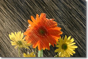
Weather Topic: What is Rain?
Home - Education - Precipitation - Rain
 Next Topic: Shelf Clouds
Precipitation in the form of water droplets is called rain.
Rain generally has a tendency to fall with less intensity over a greater period
of time, and when rainfall is more severe it is usually less sustained.
Rain is the most common form of precipitation and happens with greater frequency
depending on the season and regional influences. Cities have been shown to have
an observable effect on rainfall, due to an effect called the urban heat island.
Compared to upwind, monthly rainfall between twenty and forty miles downwind of
cities is 30% greater.
Next Topic: Shelf Clouds
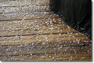
Weather Topic: What is Sleet?
Home - Education - Precipitation - Sleet
 Next Topic: Snow
Sleet is a form of precipitation in which small ice pellets are the primary
components. These ice pellets are smaller and more translucent than hailstones,
and harder than graupel. Sleet is caused by specific atmospheric conditions and
therefore typically doesn't last for extended periods of time.
The condition which leads to sleet formation requires a warmer body of air to be
wedged in between two sub-freezing bodies of air. When snow falls through a warmer
layer of air it melts, and as it falls through the next sub-freezing body of air
it freezes again, forming ice pellets known as sleet. In some cases, water
droplets don't have time to freeze before reaching the surface and the result is
freezing rain.
Next Topic: Snow
Current conditions powered by WeatherAPI.com


