Weather Alert in Arizona
Flash Flood Warning issued August 25 at 7:53PM MST until August 25 at 11:00PM MST by NWS Flagstaff AZ
AREAS AFFECTED: Yavapai, AZ
DESCRIPTION: FFWFGZ The National Weather Service in Flagstaff has issued a * Flash Flood Warning for... Yavapai County in west central Arizona... * Until 1100 PM MST. * At 753 PM MST, Doppler radar indicated thunderstorms producing heavy rain near Crown King, above Castle Creek and Humbug Creek. Between 1 and 2 inches of rain have fallen. Additional rainfall amounts up to 1 inch are possible in the warned area. Flash flooding is ongoing or expected to begin shortly. HAZARD...Life threatening flash flooding. Thunderstorms producing flash flooding. SOURCE...Radar indicated. IMPACT...Life threatening flash flooding of creeks and streams, and normally dry washes. * Some locations that will experience flash flooding include... Castle Hot Springs, Coles Bay, Castle Creek Boat Ramp, Goose Bay, Cottonwood Day Use Area, Humbug Bay, Lake Pleasant, Humbug, Casa Rosa, Crown King and Castle Creek Wilderness. This includes the following creeks, washes and rivers... North Fork Cellar Springs Creek, Whipsaw Creek, Cellar Springs Creek, Humbug Creek, Jim Creek, Tussock Spring Creek, Poland Creek, East Fork Castle Creek, Ash Creek, Boulder Creek, Cherry Creek, Buckhorn Creek, Minnehaha Creek, Tiger Creek, Cottonwood Creek, French Creek, Buzzard Roost Creek, Oak Creek, Black Butte Wash, Banty Creek, Tuscumbia Creek, Bear Creek, Castle Creek, Bitter Creek and Sand Creek.
INSTRUCTION: Be especially cautious at night when it is harder to recognize the dangers of flooding. Stay away or be swept away! The banks of creeks and washes are unstable and unsafe during any flooding event. Get out of washes and creeks if you are camping or hiking! Flooding is occurring or imminent and will inundate creeks and washes.
Want more detail? Get the Complete 7 Day and Night Detailed Forecast!
Current U.S. National Radar--Current
The Current National Weather Radar is shown below with a UTC Time (subtract 5 hours from UTC to get Eastern Time).

National Weather Forecast--Current
The Current National Weather Forecast and National Weather Map are shown below.

National Weather Forecast for Tomorrow
Tomorrow National Weather Forecast and Tomorrow National Weather Map are show below.

North America Water Vapor (Moisture)
This map shows recent moisture content over North America. Bright and colored areas show high moisture (ie, clouds); brown indicates very little moisture present; black indicates no moisture.

Weather Topic: What is Condensation?
Home - Education - Precipitation - Condensation
 Next Topic: Contrails
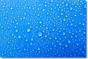
Condensation is the process which creates clouds, and therefore
it is a crucial process in the water cycle.
Condensation is the change of matter from a state of gas into a state of liquid,
and it happens because water molecules release heat into the atmosphere and
become organized into a more closely packed structure, what we might see as
water droplets.
Water is always present in the air around us as a vapor, but it's too small for
us to see. When water undergoes the process of condensation it becomes organized
into visible water droplets. You've probably seen condensation happen before on the
surface of a cold drink!
Next Topic: Contrails
Weather Topic: What are Cumulonimbus Clouds?
Home - Education - Cloud Types - Cumulonimbus Clouds
 Next Topic: Cumulus Clouds
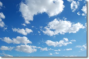
The final form taken by a growing cumulus cloud is the
cumulonimbus cloud, which is very tall and dense.
The tower of a cumulonimbus cloud can soar 23 km into the atmosphere, although
most commonly they stop growing at an altitude of 6 km.
Even small cumulonimbus clouds appear very large in comparison to other cloud types.
They can signal the approach of stormy weather, such as thunderstorms or blizzards.
Next Topic: Cumulus Clouds
Current conditions powered by WeatherAPI.com


