Weather Alert in Idaho
Hydrologic Outlook issued August 24 at 1:57PM MDT by NWS Boise ID
AREAS AFFECTED: Ada, ID; Adams, ID; Boise, ID; Camas, ID; Canyon, ID; Elmore, ID; Gem, ID; Gooding, ID; Jerome, ID; Owyhee, ID; Payette, ID; Twin Falls, ID; Valley, ID; Washington, ID; Baker, OR; Harney, OR; Malheur, OR
DESCRIPTION: ESFBOI A push of monsoonal moisture will bring several days of showers and thunderstorms to the region. Abnormally high moisture will allow for widespread heavy rain accumulation, leading to an increased threat of flash flooding. Tuesday and Wednesday currently look to have the best chance for heavy rain, especially in southeast Oregon, near the ID-NV border, and high terrain in southwest Idaho. Conditions will likely dry out considerably by the end of the week. Burn scars and steep and rocky terrain are at the most risk for flash flooding. The Wapiti Fire burn scar near Grandjean, ID, the Durkee Fire burn scar near Ironside, OR, and the Lava Fire burn scar near Cascade, ID are of particular concern for flash flooding. Recent fires also are vulnerable to flash flooding impacts. Please be aware of impacts in these areas and have multiple ways to receive flash flood warnings. Consider alternate plans if recreating near these areas.
INSTRUCTION: N/A
Want more detail? Get the Complete 7 Day and Night Detailed Forecast!
Current U.S. National Radar--Current
The Current National Weather Radar is shown below with a UTC Time (subtract 5 hours from UTC to get Eastern Time).

National Weather Forecast--Current
The Current National Weather Forecast and National Weather Map are shown below.

National Weather Forecast for Tomorrow
Tomorrow National Weather Forecast and Tomorrow National Weather Map are show below.

North America Water Vapor (Moisture)
This map shows recent moisture content over North America. Bright and colored areas show high moisture (ie, clouds); brown indicates very little moisture present; black indicates no moisture.

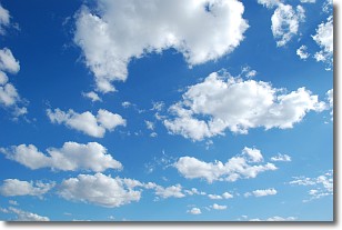
Weather Topic: What are Cumulonimbus Clouds?
Home - Education - Cloud Types - Cumulonimbus Clouds
 Next Topic: Cumulus Clouds
The final form taken by a growing cumulus cloud is the
cumulonimbus cloud, which is very tall and dense.
The tower of a cumulonimbus cloud can soar 23 km into the atmosphere, although
most commonly they stop growing at an altitude of 6 km.
Even small cumulonimbus clouds appear very large in comparison to other cloud types.
They can signal the approach of stormy weather, such as thunderstorms or blizzards.
Next Topic: Cumulus Clouds
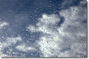
Weather Topic: What is Drizzle?
Home - Education - Precipitation - Drizzle
 Next Topic: Evaporation
Drizzle is precipitation in the form of water droplets which are
smaller than raindrops.
Drizzle is characterized by fine, gently falling droplets and typically does not
impact human habitation in a negative way. The exception to this is freezing drizzle,
a condition where drizzle freezes immediately upon reaching earth's surface.
Freezing drizzle is still less dangerous than freezing rain, but can
potentially result in hazardous road conditions.
Next Topic: Evaporation
Current conditions powered by WeatherAPI.com


