Weather Alert in Minnesota
Winter Weather Advisory issued April 2 at 4:05PM CDT until April 4 at 10:00PM CDT by NWS Twin Cities/Chanhassen MN
AREAS AFFECTED: Todd; Morrison; Mille Lacs; Kanabec; Stearns; Benton
DESCRIPTION: ...FIRST ROUND OF WINTRY PRECIPITATION IS WRAPPING UP, ANOTHER ROUND OF FREEZING RAIN AND SNOW IS EXPECTED FOR TOMORROW... .A Winter Weather Advisory for western and central Minnesota goes into effect Friday for our next wintry system. Portions of western Minnesota will see a round of freezing rain and sleet early Friday with accumulations of up to two tenths of an inch. Further north, precipitation will start out as a wintry mix before transitioning to all snow late Friday. Snowfall totals of 3 to 5 inches are expected with around a tenth of an inch of ice accumulation. East central Minnesota will see 2 to 4 inches of snow along with ice accumulations up to two tenths of an inch. * WHAT...Mixed precipitation expected. Total snow accumulations between 2 and 4 inches, sleet accumulations between one tenth and two tenths of an inch, and ice accumulations around two tenths of an inch. * WHERE...Benton, Morrison, Stearns, Todd, Kanabec, and Mille Lacs Counties. * WHEN...From 4 PM Friday to 10 PM CDT Saturday. * IMPACTS...Plan on slippery road conditions. The hazardous conditions will impact the Friday evening commute.
INSTRUCTION: Slow down and use caution while traveling. Call 5 1 1 or visit 511mn.org for road conditions.
Want more detail? Get the Complete 7 Day and Night Detailed Forecast!
Current U.S. National Radar--Current
The Current National Weather Radar is shown below with a UTC Time (subtract 5 hours from UTC to get Eastern Time).

National Weather Forecast--Current
The Current National Weather Forecast and National Weather Map are shown below.

National Weather Forecast for Tomorrow
Tomorrow National Weather Forecast and Tomorrow National Weather Map are show below.

North America Water Vapor (Moisture)
This map shows recent moisture content over North America. Bright and colored areas show high moisture (ie, clouds); brown indicates very little moisture present; black indicates no moisture.

Weather Topic: What is Evaporation?
Home - Education - Precipitation - Evaporation
 Next Topic: Fog
Evaporation is the process which returns water from the earth
back to the atmosphere, and is another crucial process in the water cycle.
Evaporation is the transformation of liquid into gas, and it happens because
molecules are excited by the application of energy and turn into vapor.
In order for water to evaporate it has to be on the surface of a body of water.
Next Topic: Fog
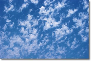
Weather Topic: What are Fractus Clouds?
Home - Education - Cloud Types - Fractus Clouds
 Next Topic: Freezing Rain
A fractus cloud (scud) is a fragmented, tattered cloud which has
likely been sheared off of another cloud. They are accessory clouds, meaning they
develop from parent clouds, and are named in a way which describes the original
cloud which contained them.
Fractus clouds which have originated from cumulus clouds are referred to as
cumulus fractus, while fractus clouds which have originated from stratus clouds
are referred to as stratus fractus. Under certain conditions a fractus cloud might
merge with another cloud, or develop into a cumulus cloud, but usually a
fractus cloud seen by itself will dissipate rapidly.
They are often observed on the leading and trailing edges of storm clouds,
and are a display of wind activity.
Next Topic: Freezing Rain
Current conditions powered by WeatherAPI.com


