Weather Alert in Oregon
Frost Advisory issued April 2 at 5:31AM PDT until April 3 at 10:00AM PDT by NWS Portland OR
AREAS AFFECTED: North Oregon Coast Range Lowlands; Central Oregon Coast Range Lowlands; North Oregon Coast Range; Central Oregon Coast Range; Lower Columbia River; Tualatin Valley; West Hills and Chehalem Mountains; Outer Southeast Portland Metro; West Central Willamette Valley; East Central Willamette Valley; West Columbia River Gorge of Oregon above 500 ft; Clackamas County Cascade Foothills; Willapa Hills; Cowlitz County Lowlands; North Clark County Lowlands; South Washington Cascade Foothills
DESCRIPTION: * WHAT...Temperatures as low as 33 to 36 will result in frost formation. * WHERE...Northern and Central Coast Range Valleys and Mountains of Oregon, Lower Columbia River and Cowlitz River Valleys, Portland Metro Hills, Central Willamette Valley, Tualatin Valley, West Columbia River Gorge of Oregon above 500 ft, Clackamas County Cascade Foothills, Willapa Hills, North Clark County Lowlands, and South Washington Cascade Foothills. * WHEN...From 9 PM this evening to 10 AM PDT Friday. * IMPACTS...Frost could harm sensitive outdoor vegetation. Sensitive outdoor plants may be killed if left uncovered.
INSTRUCTION: Take steps now to protect tender outdoor plants from the cold. Consider temporarily moving outdoor potted plants indoors if they are sensitive to cold temperatures. Consider temporarily covering sensitive plants with a lightweight cotton fabric (i.e., bedsheets, thin blankets), as this will help retain heat and provide frost protection for your plants.
Want more detail? Get the Complete 7 Day and Night Detailed Forecast!
Current U.S. National Radar--Current
The Current National Weather Radar is shown below with a UTC Time (subtract 5 hours from UTC to get Eastern Time).

National Weather Forecast--Current
The Current National Weather Forecast and National Weather Map are shown below.

National Weather Forecast for Tomorrow
Tomorrow National Weather Forecast and Tomorrow National Weather Map are show below.

North America Water Vapor (Moisture)
This map shows recent moisture content over North America. Bright and colored areas show high moisture (ie, clouds); brown indicates very little moisture present; black indicates no moisture.

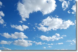
Weather Topic: What are Cumulonimbus Clouds?
Home - Education - Cloud Types - Cumulonimbus Clouds
 Next Topic: Cumulus Clouds
The final form taken by a growing cumulus cloud is the
cumulonimbus cloud, which is very tall and dense.
The tower of a cumulonimbus cloud can soar 23 km into the atmosphere, although
most commonly they stop growing at an altitude of 6 km.
Even small cumulonimbus clouds appear very large in comparison to other cloud types.
They can signal the approach of stormy weather, such as thunderstorms or blizzards.
Next Topic: Cumulus Clouds
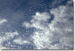
Weather Topic: What is Drizzle?
Home - Education - Precipitation - Drizzle
 Next Topic: Evaporation
Drizzle is precipitation in the form of water droplets which are
smaller than raindrops.
Drizzle is characterized by fine, gently falling droplets and typically does not
impact human habitation in a negative way. The exception to this is freezing drizzle,
a condition where drizzle freezes immediately upon reaching earth's surface.
Freezing drizzle is still less dangerous than freezing rain, but can
potentially result in hazardous road conditions.
Next Topic: Evaporation
Current conditions powered by WeatherAPI.com


