Weather Alert in Idaho
Air Quality Alert issued August 25 at 3:16PM PDT by NWS Spokane WA
AREAS AFFECTED: Latah, ID; Lewis, ID; Nez Perce, ID
DESCRIPTION: An Air Advisory Alert has been issued by the following agencies: Idaho Department of Environmental Quality in Lewiston Nez Perce Tribe * WHAT...Air Quality Advisory due to smoke from wildfires. Air Quality Index is forecast to be Unhealthy for Sensitive Groups. * WHERE...Latah, Lewis and Nez Perce Counties, and the Nez Perce Reservation. * WHEN...Until 1100 AM PDT Wednesday morning August 27th for Latah, Nez Perce and Lewis Counties, and until 1100 AM PDT Thursday morning August 28th for the Nez Perce Tribe. * IMPACTS...Members of sensitive groups may experience health effects. Those who experience health effects from smoke include children under 18, elders, pregnant women, people with asthma or have difficulty breathing, diabetes, heart problems or otherwise compromised health, and people who have high exposure (those who work, exercise, or spend extensive time outdoors).
INSTRUCTION: Air pollutants can cause breathing difficulties for children, the elderly, as well as persons with respiratory problems. Those individuals who are sensitive to increased particulate matter or smoke are encouraged to avoid prolonged or strenuous outdoor activity during this advisory. Open burning is prohibited by air quality rules. It is also recommended that all other individuals limit prolonged or strenuous activity outdoors. Idaho Department of Health and Welfare https://healthandwelfare.idaho.gov/health-wellness/environmental- health/idaho-wildfire-and-smoke-information Idaho Smoke Information Hotline: 1-800-345-1007 Idaho DEQ Lewiston Regional Office - (208)-799-4370
Want more detail? Get the Complete 7 Day and Night Detailed Forecast!
Current U.S. National Radar--Current
The Current National Weather Radar is shown below with a UTC Time (subtract 5 hours from UTC to get Eastern Time).

National Weather Forecast--Current
The Current National Weather Forecast and National Weather Map are shown below.

National Weather Forecast for Tomorrow
Tomorrow National Weather Forecast and Tomorrow National Weather Map are show below.

North America Water Vapor (Moisture)
This map shows recent moisture content over North America. Bright and colored areas show high moisture (ie, clouds); brown indicates very little moisture present; black indicates no moisture.

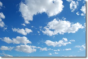
Weather Topic: What are Cumulonimbus Clouds?
Home - Education - Cloud Types - Cumulonimbus Clouds
 Next Topic: Cumulus Clouds
The final form taken by a growing cumulus cloud is the
cumulonimbus cloud, which is very tall and dense.
The tower of a cumulonimbus cloud can soar 23 km into the atmosphere, although
most commonly they stop growing at an altitude of 6 km.
Even small cumulonimbus clouds appear very large in comparison to other cloud types.
They can signal the approach of stormy weather, such as thunderstorms or blizzards.
Next Topic: Cumulus Clouds
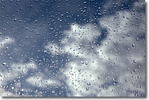
Weather Topic: What is Drizzle?
Home - Education - Precipitation - Drizzle
 Next Topic: Evaporation
Drizzle is precipitation in the form of water droplets which are
smaller than raindrops.
Drizzle is characterized by fine, gently falling droplets and typically does not
impact human habitation in a negative way. The exception to this is freezing drizzle,
a condition where drizzle freezes immediately upon reaching earth's surface.
Freezing drizzle is still less dangerous than freezing rain, but can
potentially result in hazardous road conditions.
Next Topic: Evaporation
Current conditions powered by WeatherAPI.com


