Weather Alert in Arizona
Flood Watch issued September 4 at 1:28AM MST until September 5 at 12:00AM MST by NWS Phoenix AZ
AREAS AFFECTED: Aguila Valley; Northwest Valley; Tonopah Desert; Gila Bend; Buckeye/Avondale; Cave Creek/New River; Deer Valley; Central Phoenix; North Phoenix/Glendale; New River Mesa; Scottsdale/Paradise Valley; Rio Verde/Salt River; East Valley; Fountain Hills/East Mesa; South Mountain/Ahwatukee; Southeast Valley/Queen Creek; Superior; Northwest Pinal County; West Pinal County; Apache Junction/Gold Canyon; Tonto Basin; Mazatzal Mountains; Pinal/Superstition Mountains; Sonoran Desert Natl Monument; San Carlos; Dripping Springs; Globe/Miami; Southeast Gila County
DESCRIPTION: * WHAT...Flooding caused by excessive rainfall continues to be possible. * WHERE...A portion of south central Arizona, including the following areas, Aguila Valley, Apache Junction/Gold Canyon, Buckeye/Avondale, Cave Creek/New River, Central Phoenix, Deer Valley, Dripping Springs, East Valley, Fountain Hills/East Mesa, Gila Bend, Globe/Miami, Mazatzal Mountains, New River Mesa, North Phoenix/Glendale, Northwest Pinal County, Northwest Valley, Pinal/Superstition Mountains, Rio Verde/Salt River, San Carlos, Scottsdale/Paradise Valley, Sonoran Desert Natl Monument, South Mountain/Ahwatukee, Southeast Gila County, Southeast Valley/Queen Creek, Superior, Tonopah Desert, Tonto Basin and West Pinal County. * WHEN...From noon MST today through this evening. * IMPACTS...Excessive runoff may result in flooding of rivers, creeks, streams, and other low-lying and flood-prone locations. Low-water crossings may be flooded. * ADDITIONAL DETAILS... - High atmospheric moisture content in combination with slow moving showers and thunderstorms may result in heavy rainfall and flooding in the watch area. - http://www.weather.gov/safety/flood
INSTRUCTION: You should monitor later forecasts and be alert for possible Flood Warnings. Those living in areas prone to flooding should be prepared to take action should flooding develop.
Want more detail? Get the Complete 7 Day and Night Detailed Forecast!
Current U.S. National Radar--Current
The Current National Weather Radar is shown below with a UTC Time (subtract 5 hours from UTC to get Eastern Time).

National Weather Forecast--Current
The Current National Weather Forecast and National Weather Map are shown below.

National Weather Forecast for Tomorrow
Tomorrow National Weather Forecast and Tomorrow National Weather Map are show below.

North America Water Vapor (Moisture)
This map shows recent moisture content over North America. Bright and colored areas show high moisture (ie, clouds); brown indicates very little moisture present; black indicates no moisture.

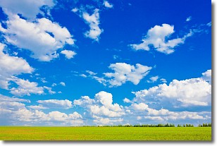
Weather Topic: What are Cumulus Clouds?
Home - Education - Cloud Types - Cumulus Clouds
 Next Topic: Drizzle
Cumulus clouds are fluffy and textured with rounded tops, and
may have flat bottoms. The border of a cumulus cloud
is clearly defined, and can have the appearance of cotton or cauliflower.
Cumulus clouds form at low altitudes (rarely above 2 km) but can grow very tall,
becoming cumulus congestus and possibly the even taller cumulonimbus clouds.
When cumulus clouds become taller, they have a greater chance of producing precipitation.
Next Topic: Drizzle
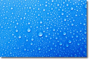
Weather Topic: What is Evaporation?
Home - Education - Precipitation - Evaporation
 Next Topic: Fog
Evaporation is the process which returns water from the earth
back to the atmosphere, and is another crucial process in the water cycle.
Evaporation is the transformation of liquid into gas, and it happens because
molecules are excited by the application of energy and turn into vapor.
In order for water to evaporate it has to be on the surface of a body of water.
Next Topic: Fog
Current conditions powered by WeatherAPI.com


