Weather Alert in South Carolina
Flood Warning issued August 23 at 9:33AM EDT by NWS Wilmington NC
AREAS AFFECTED: Horry, SC
DESCRIPTION: ...The Flood Warning continues for the following rivers in South Carolina... Waccamaw River At Conway affecting Horry County. * WHAT...Minor flooding is occurring and moderate flooding is forecast. * WHERE...Waccamaw River at Conway. * WHEN...Until further notice. * IMPACTS...At 12.0 feet, Flooding will worsen in Lees Landing, Riverfront South, Pitch Landing, and Savannah Bluff. Flooding will also worsen along Waccamaw CIR, Riverside DR, and in low areas along Gray Oak DR. Flood waters will begin to affect Black Moss DR and Cypress Flat. Depot RD, New RD, and Jackson Bluff RD may begin to flood. The lowest homes on Riverside DR north of Conway may be affected. Witch Golf Course may begin to flood. Swamps will be heavily flooded. * ADDITIONAL DETAILS... - At 9:15 AM EDT Saturday the stage was 12.0 feet. - Forecast...The river is expected to rise to a crest of 12.0 feet this afternoon. - Flood stage is 11.0 feet. - weather.gov/safety/flood
INSTRUCTION: Caution is urged when walking near riverbanks. Stay tuned to further developments by listening to your local radio, television, or NOAA Weather Radio for further information. Turn around, don't drown when encountering flooded roads. Most flood deaths occur in vehicles. Additional information is available at water.noaa.gov/wfo/ilm . The next statement will be issued by late tonight.
Want more detail? Get the Complete 7 Day and Night Detailed Forecast!
Current U.S. National Radar--Current
The Current National Weather Radar is shown below with a UTC Time (subtract 5 hours from UTC to get Eastern Time).

National Weather Forecast--Current
The Current National Weather Forecast and National Weather Map are shown below.

National Weather Forecast for Tomorrow
Tomorrow National Weather Forecast and Tomorrow National Weather Map are show below.

North America Water Vapor (Moisture)
This map shows recent moisture content over North America. Bright and colored areas show high moisture (ie, clouds); brown indicates very little moisture present; black indicates no moisture.

Weather Topic: What is Condensation?
Home - Education - Precipitation - Condensation
 Next Topic: Contrails
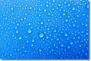
Condensation is the process which creates clouds, and therefore
it is a crucial process in the water cycle.
Condensation is the change of matter from a state of gas into a state of liquid,
and it happens because water molecules release heat into the atmosphere and
become organized into a more closely packed structure, what we might see as
water droplets.
Water is always present in the air around us as a vapor, but it's too small for
us to see. When water undergoes the process of condensation it becomes organized
into visible water droplets. You've probably seen condensation happen before on the
surface of a cold drink!
Next Topic: Contrails
Weather Topic: What are Cumulonimbus Clouds?
Home - Education - Cloud Types - Cumulonimbus Clouds
 Next Topic: Cumulus Clouds
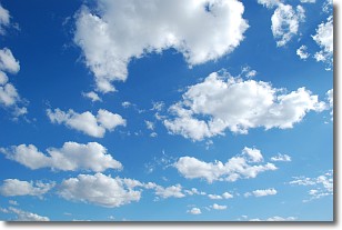
The final form taken by a growing cumulus cloud is the
cumulonimbus cloud, which is very tall and dense.
The tower of a cumulonimbus cloud can soar 23 km into the atmosphere, although
most commonly they stop growing at an altitude of 6 km.
Even small cumulonimbus clouds appear very large in comparison to other cloud types.
They can signal the approach of stormy weather, such as thunderstorms or blizzards.
Next Topic: Cumulus Clouds
Current conditions powered by WeatherAPI.com


